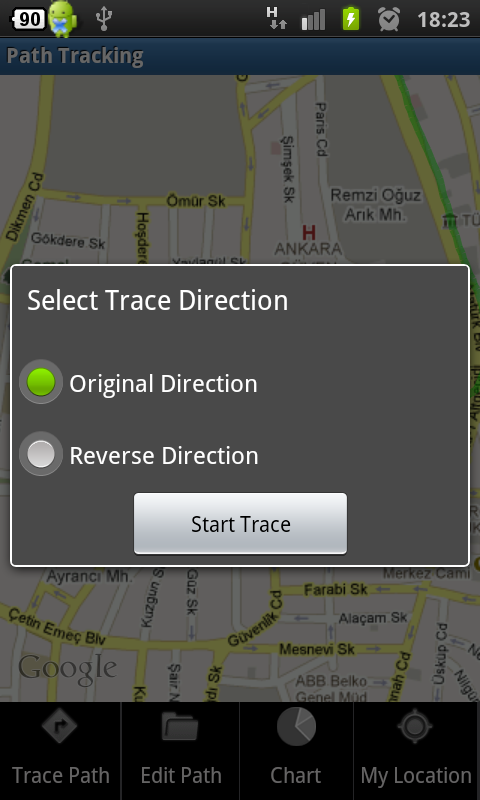
Now you can trace the saved paths. Select a path record from record list, click on "Trace Path" button on edit window, select trace direction and trace the path. Initially advice will be given to either start or end point of your path according to your trace direction selection.
This feature is only available in pro version Path Tracking .
Sunday, May 29, 2011

Saturday, April 30, 2011
Open Your Path Records With Google Maps

You can open your path records in Kml and Gpx files with Google Maps.
From "maps.google.com" select "My Maps->Create New Map->Import".
Your path will be opened with the path information.
How To Share Your Path Record With Your Friends
Path Sharing with csv file:

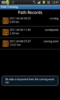
Open "Path Records" and press and hold on a record,

To load a path, select "Load Path" from menu
 Select a csv file generated by Path Tracking or
Path Tracking Lite applications
 Path will be added to path record list.

Open "Path Records" and press and hold on a record,
On options menu, select "Send Csv File"

To load a path, select "Load Path" from menu
 Select a csv file generated by Path Tracking or
Path Tracking Lite applications

Thursday, April 28, 2011
Path Tracking Lite and Pro Versions Available On Android Market
Path Tracking records your GPS positions while you perform different activities such as Walk/Run, Drive, Bike and etc.. Each activity is drawn with different color on the map. It display current and average speed, calories burned, time and distance information while performing activities. You can save and review all these information later for analysis.
FEATURES:
- Share your path information in Kml, Gpx and Csv formats
- Kml and Gpx files can be loaded from Google Maps and Google Earth
- Load previously saved path information by Path Tracker
- Statistical analysis of each record (duration, calories burned, average and maximum speed)
- Analyze performance with speed and calorie charts
- Distance and weight units can be changed from settings menu
-Take Photos during path record and preview photos in record and edit mode
Extra Features other than Path Tracking Lite:
More activities (driving, ski, horse riding, rowing, roller skating, hiking) and calorie chart are available in pro version "Path Tracking". Also there is no limit for taking photos during path record.
Uses AChartEngine by 4ViewSoft


Subscribe to:
Posts (Atom)